


The United Nations (UN) General Assembly has overwhelmingly backed a resolution recommending updating the world map projection. Its goal is to more accurately reflect the relative sizes of regions, particularly Africa, Latin America and South Asia. The only country to vote against was the United States, while six countries, including Ukraine, abstained.
For a long time, geographers relied on the world projection created in 1569 by the Flemish cartographer Gerardus Mercator. He developed it to solve practical problems of maritime navigation. Because the straight lines on this map correspond to constant compass directions, sailors could use it to plot their course. But the preservation of the direction occurred at the expense of distortion of the areas – territories further from the equator on the map appear larger than in reality.
Mercator Projection (Mdf/Wikimedia Commons (PD)
“For centuries, the Mercator projection has distorted the geography of the world, reducing Africa to the size of Greenland, when in fact our continent is 14 times larger,” says the African Union (AU).
The resolution, called “Correct the Map”, was proposed by the West African country of Togo on behalf of the African Group, which includes 54 UN member states, and was also supported by the AU. The decision is aimed at popularizing equal-area projections, such as the Equal Earth created in 2018, which allows for a more accurate display of the relative areas of the continents.
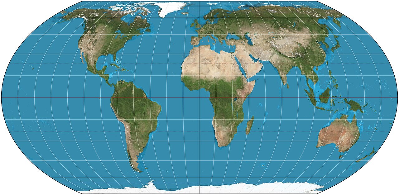
Equal Earth map variant (Strebe / Wikimedia Commons (CC BY-SA 4.0)
“Maps shape our understanding of the world. They define education, fuel the imagination and influence collective perception,” Togo's Foreign Minister Robert Dussey said before the vote.
The document mentions the need to develop international standards to more accurately represent the size of continents in digital and printed maps, to include teaching basic cartography in school curricula, and to raise awareness of the characteristics of map projections, their limitations and applications.
The resolution also mentions that the distortion extends not only to Africa, but also to Latin America and South Asia. It “contributes to the maintenance of an unbalanced view of the world” and can “fuel environmental, geopolitical and security prejudices.”
“Correcting cartographic distortions in the size of continents is an act of cognitive justice and memorial reparation, which means obtaining accurate geographical knowledge, as well as historical truth, raising awareness [о разнице проекций] and mutual understanding between peoples,” the resolution clarifies.
However, the document does not prohibit the Mercator projection and does not propose the only replacement. He encourages governments, schools, international organizations and the media to use Equal Earth in situations where the correct proportions of continents are important. Separately, the resolution focuses on clarifying the limitations of any classic card.
Despite the support of the document by 164 countries, some states abstained from voting. These included Estonia, Georgia, Lithuania, Moldova, Serbia and Ukraine. The Kyiv representative said he supports efforts to correct historical distortions affecting Africa and other regions of the Global South, but objected to the way some Equal Earth maps depict territory in the conflict zone with Russia.
European Union (EU) states supported the resolution but expressed the same concerns. Speaking on behalf of the EU, the representative of Ireland stressed that this measure concerns only the relative sizes of territories and does not affect the recognition of state borders.
“We emphasize that the resolution does not address or affect issues related to the sovereignty, territorial status, delimitation or internationally recognized boundaries of states in Europe, Africa or any other part of the world,” the European representative said.
The resolution drew criticism from the United States, which voted against it. Deputy US Representative to the UN Economic and Social Council Yarina Ferentsevich said the document “makes a mockery of the work and goals” of the United Nations.
“Instead of focusing on the real issues of international peace, prosperity and good neighborly relations, this body [Генассамблея ООН] discusses 16th-century cartographic projects and their role in promoting reparations and “cognitive justice.” Such resolutions and the ideological agenda they promote are the ballast in our work and the reason why this institution [ООН] is losing trust,” Ferentsevich emphasized.
At the same time, the UN recognizes the existence of a fundamental problem that voting will not solve. As noted on the organization’s website, no projection can perfectly reproduce the curved surface of the Earth on a plane. Each sacrifices something – area, shape, distance or direction – and each is suitable for different purposes, the organization says.
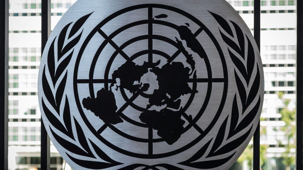
By the way, the UN itself uses a different map projection in its symbolism – azimuthal, centered on the North Pole. Approved in 1946, the design of the emblem and flag is intended to symbolize the global reach of the organization.